

High Sea Connectivity
High Sea Connectivity is a project that will provide the public and stakeholders interested in marine science and conservation with intuitive and interactive data products that demonstrate how marine ecosystems are connected. These products can provide critical information needed to adequately protect marine ecosystems around the world.
What does ‘High Sea Connectivity’ mean?
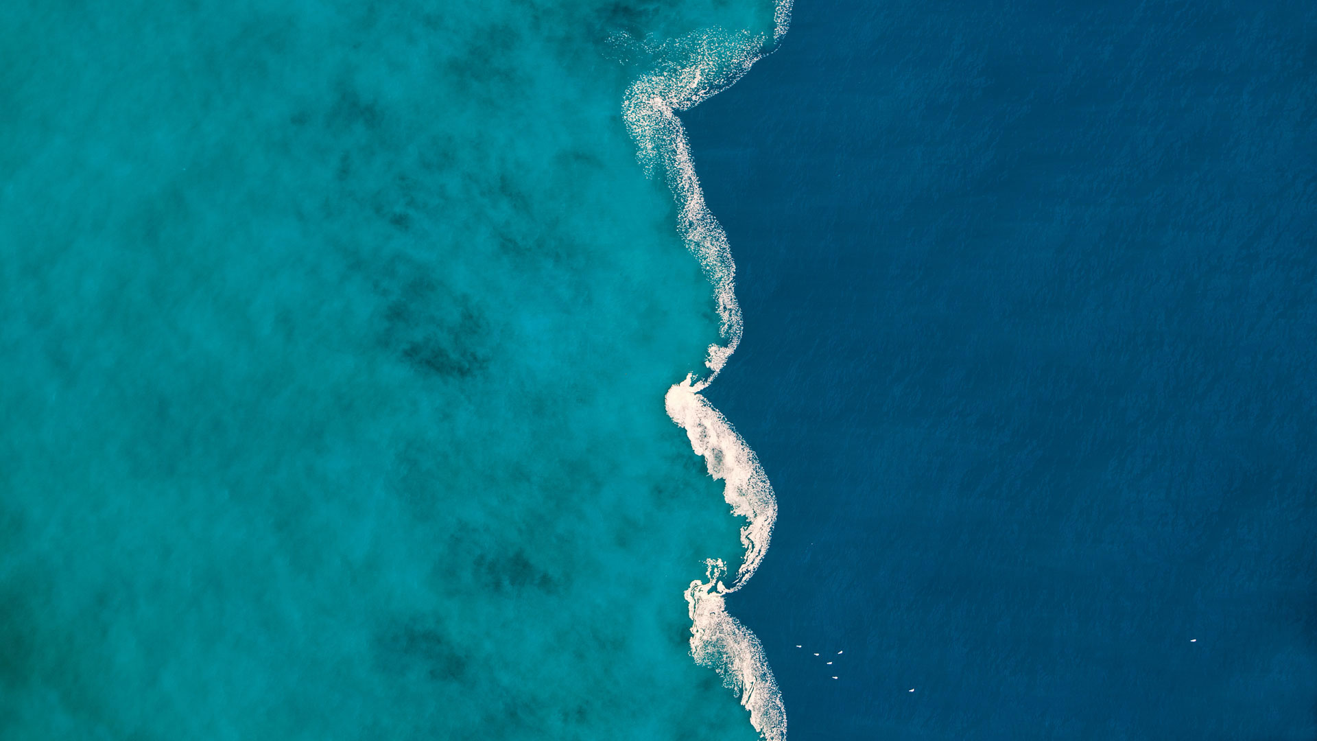
Connectivity is an ecological process by which populations of species interact across large distances. For example, the export of offspring from an isolated habitat may support a distant population if they are able to travel to and colonise this area. We are specifically interested in the dispersal of such offspring of marine species on ocean currents that can take them beyond coastal areas across areas of the open ocean, often referred to as the High Sea. Some examples would be coral and mangrove species that travel between coastal regions across the high seas or even species that inhabit hydrothermal vents, isolated ecosystems scattered across the high seas.
Background
Marine ecosystems around the world face threats from human activities, from resource exploitation to pollution. These local pressures are compounded by the global pressure climate change is exerting on these ecosystems. In response to this looming threat to the ocean and its ability to support human civilization, governments, NPOs and international organisations such as the UN aim to protect a significant percentage of the world’s oceans by classifying them as Marine Protected Areas (MPAs). Any strategy to protect an ecosystem must be based on a strong foundation of scientific understanding of how the ecosystem functions. A major knowledge gap is the way in which marine species move between areas within an ecosystem to promote population growth and maintain a resilient metacommunity, a process called connectivity. Connectivity across a marine ecosystem, that may span tens to thousands of kilometres, is driven by the transport of adult or juvenile individuals through ocean currents. With the advancement of our ability to measure and understand ocean currents, we can more accurately predict how marine species move from one area to another in a process called dispersal. These predictions of dispersal can inform the conservation of many vulnerable marine ecosystems around the globe if they can be adequately communicated by scientists to the public and decision makers responsible for conserving our oceans.
Proposal
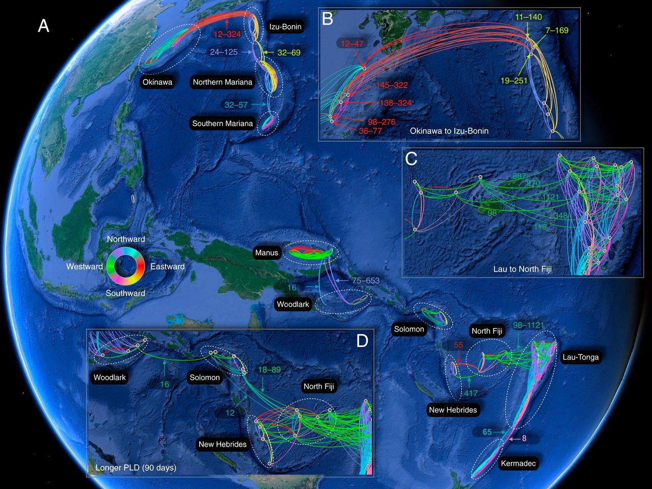
Create a website that displays connectivity data of various threatened marine species and/or habitats as an intuitive and interactive network. We will start by visualising the data that we have obtained through our ongoing research in the fields of oceanography and ecology at the University of Oxford and the Okinawa Institute of Science and Technology. These data includes connectivity networks for mangrove, coral, and hydrothermal vent species, all of which are identified as vulnerable and priorities for protection globally.
These networks will display the habitats and the connections between them, emphasising the strength of connections as well as other metrics of interest to conservationists. Each network will be interactive. Users will be able to highlight the nodes (habitats) to investigate details such as the name and location of the habitat as well as its ‘importance’ within the connectivity network. Furthermore, users will be able to remove nodes from the network at will and see the impact this has on the structure of the entire network, as well as how this affects the importance of the remaining nodes. Effectively, users will be simulating the knock-on effects a local disturbance (e.g. fishing, mining, etc.) would have on the entire ecosystem,seeing the results in real time. Finally, depending on the data underpinning the network, users will also be able to look forward in time at how the connectivity of an ecosystem is likely to change under the forecast climate change over the next 100 years.
Target Audience/Stakeholders
- The general public - can access this data and explore the vulnerability of their local marine ecosystems or even those on the other side of the world. This will help make science more approachable and interpretable.
- Policy makers – will be able to access predictions of how their actions could help to preserve marine ecosystems in a way that is built upon a strong scientific foundation.
- Scientific researchers – will have an interactive way to engage with our results, both published and yet to be published. Additionally, the data and analyses upon which the networks are built will be available in a reproducible way to encourage collaboration.
Methods
The data underpinning most of the connectivity networks will be based upon simulations of larval dispersal using Ocean General Circulation Models (OGCMs). The probability of an individual travelling between habitats will be calculated based on the simulated movement of millions of individuals on the ocean currents in the OGCM. Networks can also be built using other forms of data from population genetics or species’ distributions, but these cannot be forecast into the future in the same way as a dispersal network can.
People
Julia Janicki is a freelance data visualization specialist with a strong track record of working with ecological data that is pertinent to the conservation of vulnerable species. Their main role will be the creation of the website and visualization of the connectivity networks. For examples of their data visualisation projects visit their website.
Professor Satoshi Mitarai is the principal investigator of the marine biophysics unit who has simulated dispersal of various species and ecosystems during his career. Their role will be the oversight of the scientific data used to underpin the networks.
Otis Brunner is a PhD candidate within Prof. Mitarai’s lab at OIST researching the biogeography and dispersal of species that live at deep-sea hydrothermal vents in the Pacific Ocean. Their role will be the experimental design and analyses of data used in the dispersal networks.
Noam Vogt-Vincent is a PhD candidate and researcher at Oxford University studying the dispersal of corals in the westernIndian Ocean. Their role will be the experimental design and analyses of data used in the dispersal networks.
Contributions/Donations
If you are interested in our project and would like to support us, we are currently fundraising so you can help by spreading the word, sharing information of grant opportunities or even donating to this project yourself via the OIST Foundation.